 |

|


|
Uganda
Area Border Crossing - Malaba to TororoThe road from Nairobi to the Ugandan border demands a repeat of the trip to Nakuru (3.5 hrs!), plus a further 3-4hrs of hair raising driving on uncertain roads to Malaba. Malaba is a typical African border town, with masses of waiting HGVs to cross, and the local economy built around them! We arrived at 1830hrs, and found a clean, but basic motel to stay. We crossed to Uganda the following morning. Both the Kenyan and Ugandan border posts were hectic and haphazard as ever. It became apparent that as we had crossed into Kenya at Sand River (an unofficial Border Point), we did not have a Road Tax Permit, so we were charged for 2 full months (USD80), even though we were only a week into the second month! Actually, as we were soon to learn, the Kenyan formalities were straight forward compared with the Ugandan border procedures. Immigration into Uganda was simple. Visas were purchased on the border (USD30 each - USD 20 for students), but customs was another matter. A new customs building was in the process of being built 500m or more from the immigration point and the buildings comprising the rest of the border post and the new road linking the two points was also half made and jammed up with goods lorries waiting to be released. The process was bizarre - we had to take the Carnet to the customs chap, who would not process it until the road tax was paid. To pay this tax, we had to go to the local bank (near the immigration building!) and once we had been backwards and forwards, the receipt had to be logged in a room a couple of floors above the customs building, before the carnet was signed and stamped downstairs! Technically one should report to the police post (again beside the immigration building), but they were not bothered about us. The road to Jinja was excellent, new and smooth tar! We had heard dire warnings about poor Ugandan roads, which appeared at this point to be unfounded - that is until one considers road signs - which are non-existent! We found the quick way through Jinja to Kampala almost by accident and the road to Kampala had deteriorated somewhat. Bujagali Falls
The source of the Victoria Nile was decreed by the British explorer Speke in 1862 to be located at Rippon Falls. currently the falls are submerged under the Owen Falls Dam, a large hydro-electric dam on the edge of the town of Jinji in eastern Uganda. Downstream are Bujagali Falls, a spectacular kilometre of raging white water. We camped at Speke Camp, from where Equator Rafts operate, running adrenaline surging white water rafting trips, including a 4 day package the length of the Victoria Nile to Murchison Falls. KampalaThe traffic and roads in Kampala were quite appalling. Added to the rain on a Saturday evening the traffic jams were quite something. We bounced through the town, which could have been quite a place once upon a time - indeed the city centre and Matatu centre was one big jam, to Backpackers' Campsite on the western side of town. The place gets a great write-up, and Ozzy John, the owner certainly puts in the effort, but sadly we found some of the information from there both confused and contradictory. That said, the free internet was very welcome and the showers were certainly hot and clean. Mgahinga NP
Gorilla TrackingCritical to any successful trek is a permit from the Ugandan Wildlife Authority in Kampala (near the Sheraton Hotel), for around USD175-250 per person, depending on where you go. Booking early is essential, although it is possible to take up a standby position at the parks. Usually only groups of 6 are permitted to visit each gorilla family group per day and it is strictly controlled, yet the big tour operators over-book, allowing independent travellers the opportunity to snatch a spare place. We were told that the UWA office at Kabale can issue permits (and will only do so if there is a real chance of trekking, thus preventing a fruitless journey into each park), but we cannot substantiate this, or the fact that if you pay enough at the park, you'll get to see gorillas. It is possible to see silverback gorillas in Uganda, Rwanda and RD Congo, indeed it is probably the same family group within similar mountain ranges wandering between the artificial border areas. We were told that you can travel over to Rwanda and see gorillas there for a similar price, once all the associated visa costs are taken into consideration, though again we did not do this. Jungle Trek
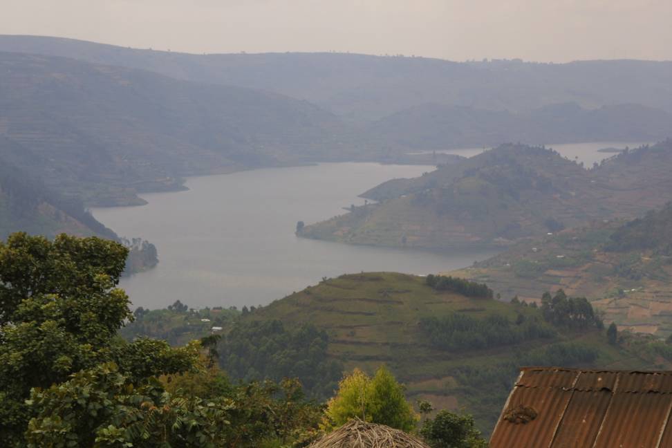
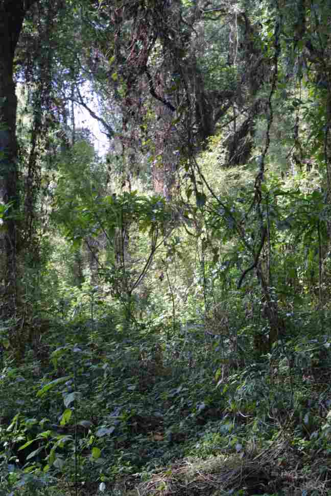
We arrived at Mgahinga, which is in the vicinity of 3 active volcanoes in the Virunga mountain range, the highest peak, which can be climbed, is Mt Muhavura at 4127m. The park is quite new and has only been a conservation area for the last few years, thus the surrounding area has been extensively farmed, on terraces and through clearing the natural habitat of the gorillas - the rain forest. In theory, there should be other primates present, both black and white, and red colobus monkeys; the rare blue and golden monkeys; elephant, buffalo and bush pigs.
Queen Elizabeth NP
For our first night at the Queen Elizabeth NP, we camped at a small site overlooking the Ishasha River, which denoted the border with the Congo. There were 5 or 6 very large hippos inhabiting the area opposite us. Our ranger, Silver, assured us that they would not be able to climb the bank to graze the grass during the night, as the bank was too steep. He was in fact right - they went to the other side, though they were very noisy all through the night. We got up at 5.30 the next morning, while it was still dark, to go on our 6.30 game drive. We saw many ungulates, elephant and buffalo herds, but the famous tree climbing lions remained elusive.
Following our game drive in the Ishasha area, we left for the northern sector of the park, staying at Mweya Lodge, with spectacular views, being situated at the head of Lake Edward overlooking the Kazinga Channel. This northern area contains many crater lakes and the channel links Lake Edward to Lake George.
Whilst driving to Lake George, we noticed that the locals were harvesting salt on the surface of one of the soda lakes.
Fort Portal/Kibale
Murchison Falls NP
Maps and DirectionsWe relied on the Footprints East Africa Handbook 2000, which hitherto had been very good for Kenya and Tanzania, but which we found did not provide clear information or maps for Uganda. This is in part due to the fact that Uganda is developing very rapidly at present. We borrowed a Brandt Guide for Uganda, which appeared much better and provided an excellent sketch map for our journey between Mgahinga and QEP, without which the journey would have been practically impossible because our map coverage was limited to the main towns and roads using our "Illustrated Road Atlas of Africa". We note that the Nelle Uganda map appears quite comprehensive. Our poor map coverage was compounede by the non existent sign posting, particularly on the back roads. ImpressionsWinston Chirchill described Uganda as the 'Pearl of Africa' and it is easy to see why. The country is fantastically green and fertile - commercial cultivation has resummed in earnest and the once renound tea and coffee plantations are back on their feet. Uganda is a country which has suffered around 30 years of strife and neglect. However, there are signs of recovery and foreign investment, which is greatly needed to develop the country. The mobile phone network is impressive, reaching even the most remote areas within the National Park areas. Many of the roads have been improved, and the matatu system is probably the most effective in Africa, being strictly regulated. Unfortunately most of the National Parks suffered heavily from guerilla and foreign armies which decimated the wildlife, although there is a school of thought which says that the parks were originally overpopulated, particularly in the case of elephant, so that this "cull" could in fact be regarded as a helpful measure in population control, as now the wildlife is beginning to recover. We found the Ugandan people to be warm, hospitable and very gentle. The country has not yet been spoiled by tourism. Kampala is a typical African city with appalling roads, and bumper to bumper traffic. there is an almost total dependence on charcoal and firewood for cooking, so there was a great deal of smog. Even at the height of the war between Tanzania and Uganda, the Owen Falls Dam, which provided electricity for Kampala, most of the country and for parts of Kenya, was still maintained and functioned well. It is an interesting fact that no matter how bad the potholes are on the roads, particularly in East Africa, there are speed bumps which are rigorously maintained, in the areas of towns and villages. It is difficult to understand how this comes about, but it is true, and extremely irritating for those wishing to get around whilst maintaining intact suspension. Top of the Page |


 We only stayed in Kampala the one night, pressing onto Mgahinga NP (in preference to
Bwindi [the Impenetrable Forest] NP) to try and track gorillas. The road south was reasonable tar (some
areas potholed), but again very poor (non-existent exiting from Kampala) road signs. Once at Kabale, there
is a further 88km dirt road to Mgahinga, which is OK, but slow as it winds through steep hills and valleys.
The journey took some 5-6 hrs steady driving, through a very fertile and well cultivated area. Both
stable crops and cash crops (rice, tea and coffee) were evident on what looked like a commercial basis.
We only stayed in Kampala the one night, pressing onto Mgahinga NP (in preference to
Bwindi [the Impenetrable Forest] NP) to try and track gorillas. The road south was reasonable tar (some
areas potholed), but again very poor (non-existent exiting from Kampala) road signs. Once at Kabale, there
is a further 88km dirt road to Mgahinga, which is OK, but slow as it winds through steep hills and valleys.
The journey took some 5-6 hrs steady driving, through a very fertile and well cultivated area. Both
stable crops and cash crops (rice, tea and coffee) were evident on what looked like a commercial basis.


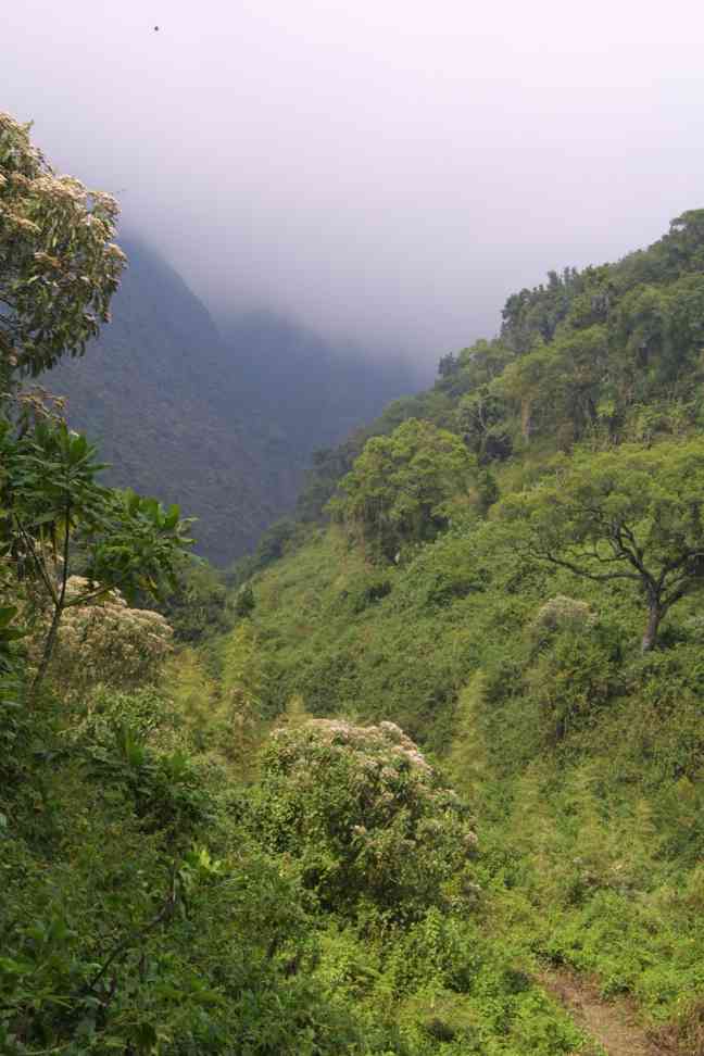
 We felt the sums required to trek gorillas for a few hours were exorbitant (although
if it saves an endangered species it is worth it), but not for us. Instead, we went on a nature trail, which ended
up being typically African. Due to the hostage taking of tourists in Bwindi in March 1999, the
Ugandan Army are patrolling the borders and deterring the rebel groups from crossing the border.
Whilst we slept soundly at night due to the added security on the border area, the situation led to the nature walk being
escorted by soldiers. Alarm bells started to ring when the 6 gorilla trekkers left, escorted by 30
heavily armed soldiers (carrying hand-held anti-tank weapons in a jungle environment? - what sort of
armoury were the gorillas packing?).
We felt the sums required to trek gorillas for a few hours were exorbitant (although
if it saves an endangered species it is worth it), but not for us. Instead, we went on a nature trail, which ended
up being typically African. Due to the hostage taking of tourists in Bwindi in March 1999, the
Ugandan Army are patrolling the borders and deterring the rebel groups from crossing the border.
Whilst we slept soundly at night due to the added security on the border area, the situation led to the nature walk being
escorted by soldiers. Alarm bells started to ring when the 6 gorilla trekkers left, escorted by 30
heavily armed soldiers (carrying hand-held anti-tank weapons in a jungle environment? - what sort of
armoury were the gorillas packing?).
 So when the two of us left with 15 or so similarly armed and chatting soldiers - we instantly
realised the chances of sneaking up on a rare primate was exceedingly remote - which it was. I dare say the
soldiers were not too impressed at having to walk half-way up a mountain, but seeing nothing in 4 hrs was
irritating for us! As for the gorilla trek, they glimpsed the silverbacks across the border in the Congo,
but were unable to get close.
So when the two of us left with 15 or so similarly armed and chatting soldiers - we instantly
realised the chances of sneaking up on a rare primate was exceedingly remote - which it was. I dare say the
soldiers were not too impressed at having to walk half-way up a mountain, but seeing nothing in 4 hrs was
irritating for us! As for the gorilla trek, they glimpsed the silverbacks across the border in the Congo,
but were unable to get close.
 Queen Elizabeth Park lies across the equator in the south west of Uganda. The soils of the park are derived from relatively young volcanic deposits, thus differing from those occurring in most of the rest of the country. The area of the park encompasses semi-deciduous forest, small areas of swamp forest, many types of thicket vegetation, and savannah, which covers most of the park. Here, the dominant plant is grass, and this provides food for the many herbivores supported by the park. It borders on Lake Edward, the Kazinga Channel, Lake George and the Semliki River. The Ugandan kob, now unique to this country, used to roam freely across East Africa. Similar in stature to an impala, but larger with longer horns and a golden brown colour without the black marks on the hind quarters is eaisly spotted throughout the park.


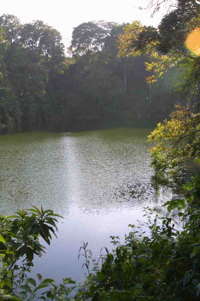 The journey from QEP to Murchison Falls was between 6-8 hours, so we decided to stopover in the Kibale region. On the lower slopes of the Rwenzori Mountains at 1,230 metres, the Kibale Forest provides a rich habitat for a wide variety of primates and bird life. Chimpanzees can be trekked here. The road to the forest passes through Fort Portal, a former colonial town retaining some of the charm from that era. It is a district headquarters for the surrounding area, and is the last major town before hitting the snow covered peaks of the Rwenzori Mountains (the Mountains of the Moon). Fort Portal is a bustling market town with many facilities, including an internet cafe. We camped at Lake Nkurube, a small crater lake within the Kibale conservation area. The campsite facilities were basic, but there was a bush shower, for which we were provided with hot water. We were told that the lake was safe to swim in, and it was possible to camp on the edge of the water (though our campsite was on the crater rim above the lake). Walking round the edge of the lake, we saw a family of black and white colobus monkeys, who seemed as interested in watching us as we were to watch them!
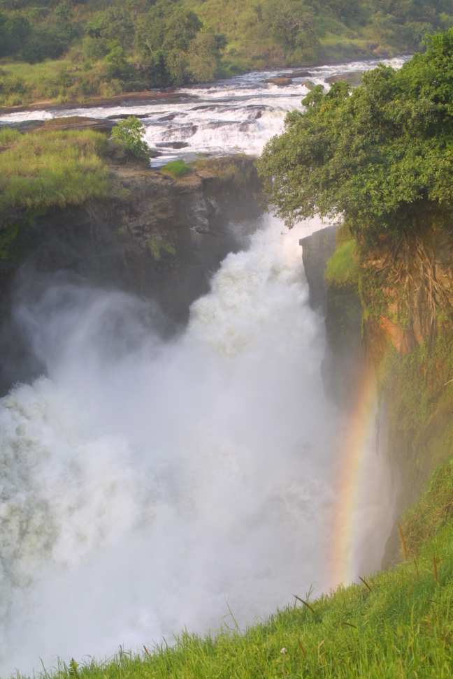 Murchison Falls NP is the largest in Uganda, covering an area of around 4,000 square km. There was reported to have been a recent cross border incident from the Congo concerning a refugee camp to the north, but this should not discourage visitors to the park. Forty years or so ago, the Victoria Nile was forced through a narrow gap of rocks, creating a foaming, roaring cascade which dropped 50 metres or more. However, since heavy rains in 1961, a second breach has occurred in the rocks. Between Chobe and Paraa the Nile plunges 350 metres before emptying into Lake Albert.
 It is possible to camp at a bare campsite above the falls, though we decided against this as the area appeared to be infested by tetse fly. Instead, we camped at an excellent rest camp which had recently been taken over by the proprietors of the Kampala Red Chilli Hideaway, Debbie and Steve (website is redchillihideaway.com). They had bought the site 4 days before we arrived, and had plans to put in hot water (currently only cold water showers existed), improve the bar area and add a waterhole so that people in the restaurant and bar area could watch animals, particularly in the dry season. The site had a tame bushbuck, which had been hand reared, a pair of marabu storks and a family of wart hogs. We were told that hippo grazed there overnight, and they were more or less used to humans but we did not see them. The bar was well stocked and there was an excellent breakfast and evening meal menu.
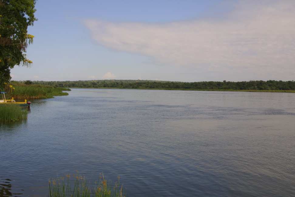 From Paraa, which means the place of the hippo, a 3 hour river cruise can be taken to the base of the falls. Although we skipped this option, it is possible to see crocodiles, hippos and other wildlife.
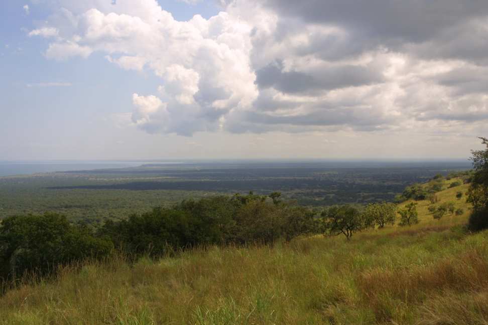 The road from Masindi has recently been regraded, and is the best route into the park. However, on our return journey to Kampala, we took the extended route up the escarpment and along the coastline of Lake Albert. This offered stunning views across the lake and border into the Congo.